Strongest Windstorm in Decades Bears Down on Upper Midwest
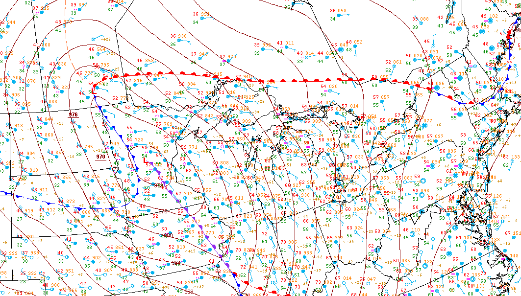
The worst windstorm to bear down on the upper Midwest in decades is beginning to fall into place. The extremely powerful low pressure system is expected to reach a minimum pressure of 957mb (or 28.26 inches of mercury)! Typical air pressure values are about 1013mb (29.92 inHg), while values as low as those expected from this storm are typically found only in a major, Category 3 hurricane! The surface map below from 5AM this morning shows minimum pressure values of 970.9mb, so the storm is still strengthening!

Also note the red lines on the map. These are isobars – lines where the pressure is equal along them (approximately, of course). The important factor with these isobars is that the closer they are packed together, the stronger the wind field will be. These isobars are packed very tightly together, and this trend is only expected to increase.
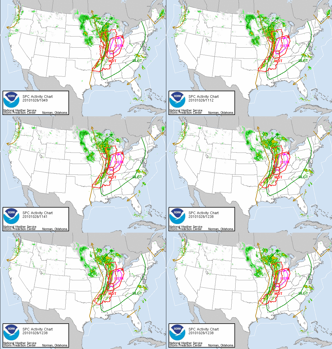
This low pressure system has a very powerful cold front attached to it which is poised to spawn a severe weather outbreak across the upper Midwest (namely Illinois) into the Ohio Valley, and potentially even farther east, possibly throwing some severe wind gusts in the Pittsburgh area by late evening Tuesday. In fact, the National Weather Service’s Storm Prediction Center, which issues all severe weather outlooks and watches for the country has placed nearly the entire state of Indiana and western Ohio under a High Risk for severe weather with more of the country under moderate or slight risk. High risk days are very rare – there have only been 5 other High Risk days this year and this was a rather busy year (there were only 2 high risk days in 2009). This is also one of the latest high risk days, which are much more “commonly” found in springtime during the Midwest “tornado season”. There have been high risk days in every month of the year, but the previous latest day in the year was November 15, 2005.
High Risk days are not issued lightly. They are only issued when there is a very high likelihood for a major severe weather impact. For more on today’s weather outbreak, take a look at the SPC’s Public Severe Weather Outlook.

(The red “boxes” on this chart are tornado watches. Note that this is a static image from 8:30AM and will not update throughout the day.)
It certainly appears to be shaping up to be a very interesting (and certainly windy, if nothing else) day.
Sources
Images courtesy the National Weather Service
High Risk day information gathered from Wikipedia – List of SPC High-Risk Days (Accessed Oct. 26, 2010)