Anatomy of a "Surprise" Thunderstorm
The past few days have been very interesting in terms of weather. A massive storm has moved across the country, bringing anything from blizzard conditions to severe ice accumulation. In Latrobe, one of the results was a strong, but very brief thunderstorm that rumbled through Wednesday morning about 8:40AM. The storm surely looked impressive on radar, especially by February standards!
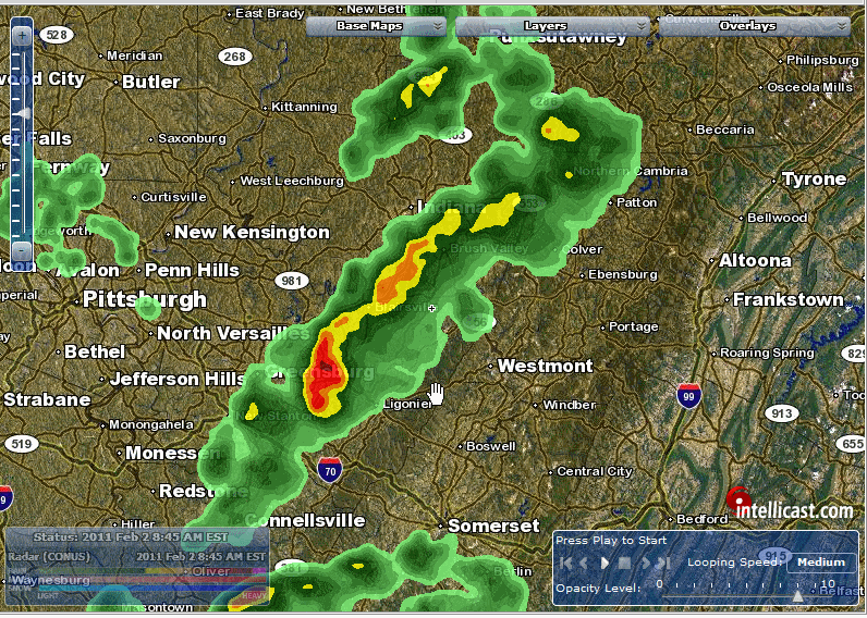
8:45 AM Radar from Intellicast
The storm was recorded in a special METAR observation. Normally, these automated observations occur around 50 past the hour, as the image below shows. However, if particularly “interesting” (as the system recognizes it) weather occurs, it can also make a special observation. Such was the case here. The circled portion of the report describes the active weather at the time. It reports light rain associated with a thunderstorm, and ice pellets. Some of the other details, not shown on that chart, include “observed” occasional cloud-to-ground lightning. There’s quite a bit of information you can get from this single automated report!*
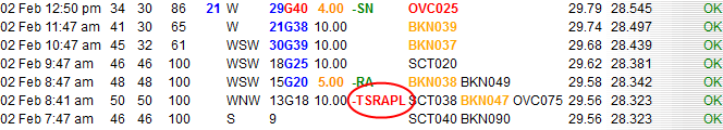
One other thing apparently with even that chunk of weather observations in Latrobe is that the cold front passed through at that moment. This can be deduced in several ways. First, we see that the temperature peaks at a whopping 50 degrees at 8:41AM (surprising in February for sure). The temperature begins a pretty [rapid] decent after that point. There was also a wind shift, as winds changed slightly from the WNW to the WSW after that observation. Finally, the pressure reached a minimum at the time of that observation and began to rise again afterwards. A pressure minimum is a surefire sign of frontal passage.
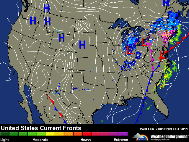
This frontal passage is confirmed on a Weather Underground** surface map from 8:32AM. An occluded front passed through the region at that moment, and the combined effects of warmer, moist, and unstable air led to a very interesting (and unusual) February thunderstorm.
* - The full coded METAR read:
KLBE 021341Z 29011G16KT 10SM -TSRAPL SCT038 BKN047 OVC075 10/10 A2956 RMK CB MOV ENE OCNL LTGCG
** - ** – Speaking of the Weather Underground, they just launched an overhauled version of their website yesterday. As always, there has been considerable debate about the design, but I tend to like it. Go check it out for yourself!